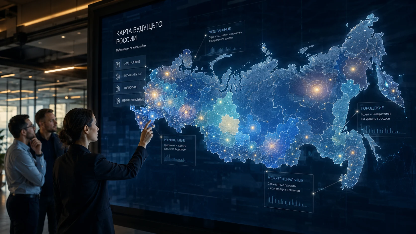
A new mechanism has appeared on the Futurating platform — Map of the Future of Russia. This is an interactive map that shows which images of the future, ideas, projects, and publications are linked to specific territories of the country.
Now, a publication on the platform can be more than just text, a rating, or an author’s contribution. It can also gain a geographical scale: from a single city to the whole of Russia.
Why the Map of the Future is needed
Futurating was created as a platform where people formulate desirable, probable, and significant futures. But the future is always tied not only to themes, technologies, and ideas, but also to territories.
Some publications concern the entire country. Others concern a specific region, city, or group of regions. Still others describe global, planetary processes and do not require a link to the map of Russia.
The Map of the Future helps to see where exactly ideas of the future are born and for which territories they are proposed.
How the mechanism works
When creating a publication, the author can choose one of several geography options:
- Without geographical reference — planetary publication
- All of Russia — federal publication
- Multiple regions — interregional publication
- Region — regional publication
- City — city publication
If a publication is not linked to a specific territory of Russia, it is saved without a map reference. This is the default mode for general, global, philosophical, and planetary topics.
If a publication relates to Russia, a region, a city, or several regions, it can be displayed on the Map of the Future.
Federal, regional, and city publications
A federal publication relates to all of Russia. For example, if an author writes about a new education system, scientific policy, technological development, or demography for the entire country, such a publication gets the scale «All of Russia».
A regional publication relates to a specific subject of the Russian Federation. For example, Perm Krai, Tatarstan, Sverdlovsk Oblast, or any other region.
A city publication relates to a specific city within a region. For example, Perm, Kazan, Yekaterinburg, or Novosibirsk. In this case, the region is highlighted on the map, and the city is indicated as a specification inside the publication card.
An interregional publication links several territories. For example, if it concerns the industrial belt of the Urals and the Volga region, a transport corridor, a tourist route, or a joint initiative of several regions.
Why federal publications are not duplicated across regions
If a publication relates to all of Russia, it is not created separately for each region. It is one publication with one rating, one page, one set of comments, and one list of contributions.
But the map understands: if a publication is federal, it means it affects every region of the country.
This approach avoids duplicating materials and maintains honest data structure. A federal publication remains federal, and regional publications are not lost among the nationwide agenda.
Map statistics
The Map of the Future displays overall statistics for all of Russia. Users can see how many publications are already linked to the map, how many regions have materials, how many participants, contributions, and contribution points have been gathered around territorial images of the future.
A separate block, «Map Pulse», shows what share of subjects already have publications and what percentage of materials are linked to a specific territory. This helps to understand how actively different regions are engaging in shaping the future.
The map also shows the structure of publications by scale: federal, regional, city, and interregional. And a leaderboard by activity allows you to see which regions currently have the most proprietary and interregional publications.
When a specific region is selected, a summary for that region opens: the territory’s own publications, all publications affecting the region, participants, contributions, contribution participants, contribution points, and the strongest topics. This makes the map not just a navigation tool but an analytical instrument of the platform.
What the user sees on the map
The user opens the Map of the Future of Russia and sees regions that already have publications. The more publications linked to a territory, the more prominent the region appears on the map.
When selecting a region, the user can see publications associated with that territory. First, the region’s own publications are shown, then interregional publications involving that territory, and then federal publications that affect the entire country.
This allows you to view the future not just as a set of individual ideas, but as a territorial picture of Russia’s development.
Region pages and internal navigation
The Map of the Future of Russia is not only a visual display of publications on the map. A separate page is generated for each region, gathering all related information: publications, authors, views, subscribers, user contributions, and contribution points.
On the region page, you can see which materials relate to the territory, how many publications the region has, how many authors are involved in shaping its image of the future, how many users have contributed, and how actively the region’s ideas are supported.
Inside the regional page, navigation through publications works. Materials can be viewed as new, popular, top-rated, discussed, by rating, or separately as articles. A time horizon filter is also available to see which publications relate to the near, medium-term, or more distant future.
Thus, each region gets not just a point on the map, but its own showcase of the future: with statistics, publications, authors, participant contributions, and internal navigation through materials.
What this gives regions
For regions, the Map of the Future can become a separate public tool.
It can be used to see what ideas residents propose for the region, which topics are most often discussed, which publications gain support, which interregional initiatives are linked to the territory, which federal ideas are important for the region, and which people are ready to contribute to the implementation of the proposed image of the future.
Now every region can have its own page with publications, statistics, authors, subscribers, contributions, and navigation through materials. This turns the map into a regional slice of the platform: you can see not only individual ideas but also the overall picture of how the territory is represented in the future.
This creates not just a list of publications, but an image of the future of a specific territory.
What this gives the platform
The Map of the Future strengthens the very idea of Futurating.
The platform becomes not only a place for publishing postulates but also a space where images of the future can be collected, compared, and analyzed across the entire country.
Futurating is gradually turning into:
- a map of the future of Russia;
- a bank of ideas by region;
- a public tool for collecting images of the future;
- a platform for authors, experts, regions, and citizens;
- a foundation for a future regional ranking.
Next step
Map of the Future of Russia is not just a visual section of the website. It is a new way to show where exactly the future is being shaped and which territories are already involved in discussing it.
Now every publication on Futurating can be linked to a place: a city, a region, several regions, or the entire country.
This makes the future not abstract, but visible on the map.
Comments (0)